Spring is in the air, and the season is changing. Trees are starting to show their impressive new buds, the smell of skunk cabbage is faintly in the air, and the white-tipped mountains are just starting to meltdown into valleys. With the changing of the weather, you know what that means – it’s the perfect time to get outside and go chasing waterfalls!
If you are seeking beautiful unpopulated natural settings, then the Alberni Valley might just have what you are looking for! Exploring the many waterfalls in the Alberni Valley is a must, nothing beats the misty Spray of freshwater from these falls or the mossy fern-lined paths that guide you to the base of these waterfalls. Whether you are looking for a rush of adventure, or a walk with your family – The Alberni Valley has a range of distinctly unique waterfalls.
But first, like any destination, we want to ensure that our home, and natural spaces remain clean, unpolluted, safe for everyone, and environmentally healthy. To do this, we ask that any place or site that you visit is respected and cared for. Here are a few tips we offer our visitors before visiting these remarkable places:
- Pack out what you pack in. Some of these areas do not have readily available trash cans. Be sure to take a backpack to store all your items.
- Stay on the designated trails. Our natural areas are beautiful because we value their ecosystems.
- If you find something cool (rock, wood, shell etc.), please leave it there for others to enjoy. Take only pictures.
- Be a steward of the land, if you see others behaving disrespectfully please remind them that this is a special place worth treating with respect.
Note: All trail lengths, ratings, and elevation gains are approximate. Always do your research before choosing a trail.
Now that you’re prepared to explore the Alberni Valley, here are 7 stunning waterfalls that will renew your senses and recharge your spirit this spring:
Fossli Park Falls
Difficulty: Easy
Accessibility: No wheelchair access point, or wheelchair accessible trails
Trail Features: Suspension bridge
Suitable For: Pets, Children, Swimming
Length: 1 hour (3.4 km), 96m elevation gain
Trailhead Coordinates: N 49° 14′ 31.404” W 124° 56′ 50.919”
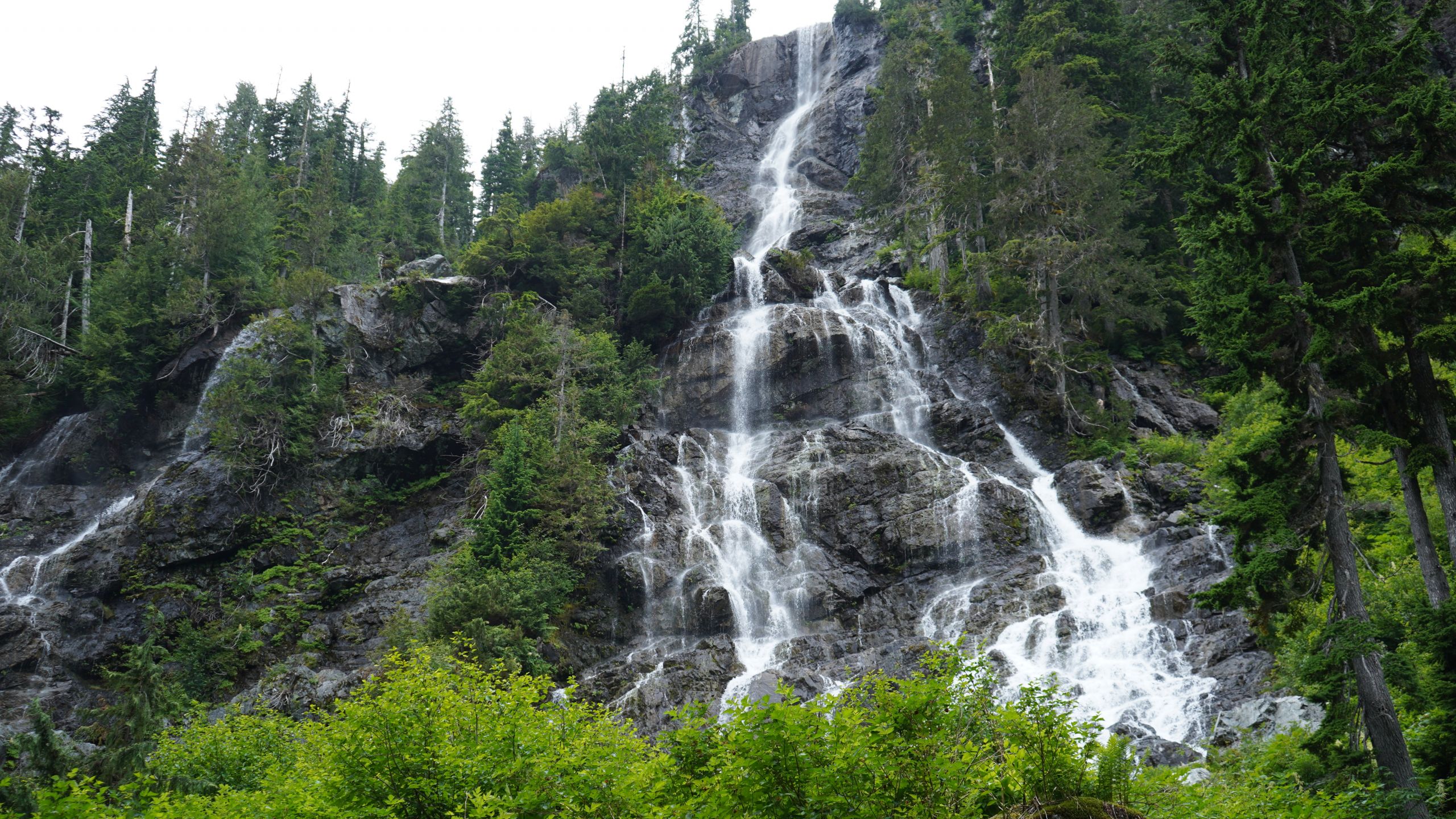
Fossli Park is a Provincial Park on the south side of Stirling Arm, Sproat Lake. The name of the park originates from Norwegian settlers to the area who named it after the waterfalls. Fossli is a Norwegian word meaning “waterfall in the valley”.
To get to the trailhead you will have to drive on logging roads, so caution while driving should be taken. The park trail leads you through old Mossy Maple trees and parallels the river system most of the way. The trail will lead you to a suspension bridge that crosses over St. Andrew’s Creek. Past the bridge, you will reach Fossli waterfall. Continuing hiking will bring you to the shore of Sproat Lake, a great spot for a dip. Note that there is no designated swimming area in this park, and there are no lifeguards on duty.
The waterfall itself is surrounded by large boulders and moss-covered edges. You can view the waterfall from the top, or loop around to the base of the falls.
Cold Creek Waterfalls
Difficulty: Easy
Accessibility: No wheelchair access point, or wheelchair accessible trails
Suitable For: Pets, Children
Length: 2 hrs round trip (9km)
Cold Creek Waterfalls is an easy to access waterfall, to get to the falls you can park by Coombs Country Candy and follow the old log train trail straight to the falls. Following the log train trail for about 5km, you will start to see the terrain change to a lusher surrounding. After a steeper descent, you will cross a short bridge and see the ‘Cold Creek Falls’ sign to your right. This is where it starts to get exciting! The trail to the falls is surrounded by ferns and a small creek, as you approach the falls you will marvel at old fallen trees and boulders that have fallen in years past. At the base of the falls there is a large rock wall to its left, this augments to the entire view and is the perfect spot for a photoshoot. The trail is less manicured as you get closer you get to the falls. Caution should be taken as the ground can be slippery and uneven.
Della Falls
Difficulty: Difficult
Accessibility:No wheelchair access point, or wheelchair accessible trails
Trail features: bridges, cable cars, ladders, ropes, and small sections of scrambling
Suitable For:Pets (experienced with backcountry), Children (10+), Swimming
Length: 3 days return (31.2 km return)
Trailhead Coordinates: 49.39181, 125.40838
Della Falls is located 60 km from the city of Port Alberni, in Strathcona Provincial Park.
The only way to reach Della Falls, other than by helicopter, is by crossing Great Central Lake by boat. After you cross Great Central Lake, there is a dock that marks the beginning of Strathcona Park, and a camping area which can be used as a base camp before trying the next 15 km ascent to the base of Della Falls. The hike, part of which follows an old logging railway, takes about seven hours one way and is suitable for intermediate level hikers. As the trail continues it does get steeper, particularly after you pass the old log trail; the cable car marks the end of the road. Beyond the cable car the trail gets much rougher and offers some spectacular views! You will see monster boulders, huge trees, and towering cliffs, avalanche chutes and brush fields.
Before you get to Della Falls you’ll come to a fork in the trail. The right fork takes you up the incredibly steep wall of the valley to a cirque with a little lake in it – Love Lake. It’s from Love Lake that the best views of Della Falls can be had. It’s a steep, 1.5 hour, 3 km climb with a 675m elevation difference. Most people set up their tents near the base of Della Falls and hike Love Lake as a day trip.
The entire journey up to the falls is noteworthy, there are many water features to view, and depending on your level of fitness, there are campsites along the trail before reaching Della Falls. Della Falls is breathtaking! The waterfalls for what seems like an eternity and is placed among majestic mountain views and giant trees.
Weiner Falls
Difficulty: Medium
Accessibility: No wheelchair access point, or wheelchair accessible trails
Trail features: ropes, and small sections of scrambling
Suitable For: Pets (experienced with backcountry), Children (10+), Swimming
Length: 40 minutes round trip (1.65 km)
Trailhead Coordinates: 49.28942, 124.98904
Weiner Falls looks like it came out of a fairy tale story. You can access the falls from the top, or scramble down to the base, where there is an inviting, yet chilly, plunge pool. The falls are wrapped around towers of fern-lined rock walls and a canopy of trees overhead. To get to the falls you take a short uphill hike through the Alberni Valley Community Forest which takes you straight to the falls.
For the adventure seekers, you will find a rope tied to the top of the descending trail, for those who are afraid of heights, this might take some getting used to. Take your time and allow the rope to guide you through the steep, muddy, wall face – we promise you; it is worth it! Once you get to the base of the falls you can explore around the falls and follow the creek through smoothed rocks.
Kitsuksis Creek Falls
Difficulty: Easy
Accessibility: wheelchair access, stroller friendly
Trail features: level ground, paved sections
Suitable For: Pets, children, seniors
Length: 45 minutes-1 hr round trip
Trailhead Coordinates: N 49° 15′ 38.873” W 124° 49′ 2.064”
If you only have a limited amount of time to explore Port Alberni, we suggest you take a walk along the Kitsuksis Dyke and have a gander at the falls! This walk is perfect for anyone and everyone. The trail is evenly paved and offers a nice 1.5km walking loop. The northernmost section of the trail consists of a dirt path that passes through a mature grand fir forest, to a waterfall at the railway trestle that spans Kitsuksis Creek. The falls are perfectly centred under the trestle and provide the perfect opportunity to sit at the bench and take in the surrounding area. For a trail located in the middle of the city, there are also great opportunities to view wildlife, such as birds, black bears, and coho salmon.
Stamp Falls (Stamp River Provincial Park)
Difficulty: Easy
Accessibility: wheelchair access, stroller friendly
Trail features: level ground, paved sections, salmon ladder
Suitable For: Pets, children, seniors
Length: 15 minutes (30 minutes round trip)
Relax by the waterfall at this peaceful riverside park or explore the area by foot on hiking trails that weave their way through the lush forest, past waterfalls and river rapids. This park is named after the pioneer who built Port Alberni’s earliest sawmill, this park is an amalgamation of Stamp Falls and Money’s Pool provincial parks.
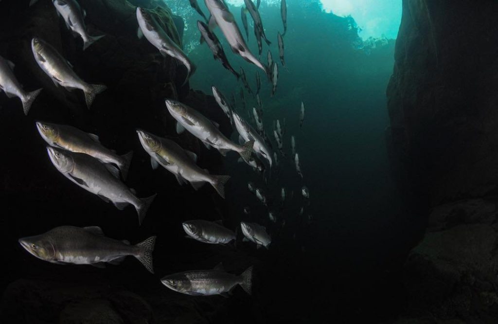
One of the main attractions, besides the stunning falls, is the annual run of thousands of Pacific salmon circling in the pool below Stamp Falls before ascending the fish ladders on their way to spawning beds. Lookout points along the river offer excellent views of the salmon fighting their way up the falls and fish ladders.
This fall might not be the tallest, but it’s power and the sheer volume of water that cascades down is amazing! The more time you spend at this waterfall, the more apparent it becomes that natural places like Stamp Falls breathe life into the forest and provides an environment that supports so many living systems.
If you are looking for more adventure, Stamp Falls offers trails along the river, which can be accessed either on the south or north ends. These trails are moderate in difficulty and are about 8 km. Ancient firs and cedars can be found along the length of the trail, but there is a particularly fine stand of old-growth near the north end. Eagles, hawks, mergansers, dippers and other water birds are frequently seen.
China Creek Falls
Difficulty: Moderate
Accessibility: No wheelchair accesses
Trail features: Ledges with rope, steep sections
Suitable For: Pets, children, swimming
Length: 45 minutes- 1 hr round trip (4.6 km)
Trailhead Coordinates: N 49°11’02.9400″ W 124°45’39.6600″
If you like going off the beaten path, then China Creek Falls is the adventure for you. Use the trailhead coordinates to find the trailhead, then park near the gate to a large gravel pit, walk down the main road a few meters, and you’ll see a very small trail marked by flags in the tress above. There is no designated parking or trailhead, and it is located on a very busy logging road, caution should be exercised.
The approach to the falls highlights the beautiful forests of the Alberni Valley, the hike itself is about 25 minutes to the falls. Sections along the way that are worth stopping at are swimming holes, and the riverbanks. You can find fallen trees, turned bridges, and crystal-clear waters showcasing the greens and blue river stone beds.
To reach the falls you will have to climb down a steeper slop where you will find large boulders circumference the waterfall pool. People usually lounge on the rocks and dip into the pool on those particularly hot days. There is a rope swing located on the left side of the falls for those who can brave the cold water long enough to swim to it.
This guest blog article was written by Port Alberni resident Genevieve Huneault, Principal Consultant at Social Root Consulting for the City of Port Alberni and Alberni Valley Tourism.